Cozumel, Quintana Roo
Playa Centro is it worth it today?
Loading beach conditions…
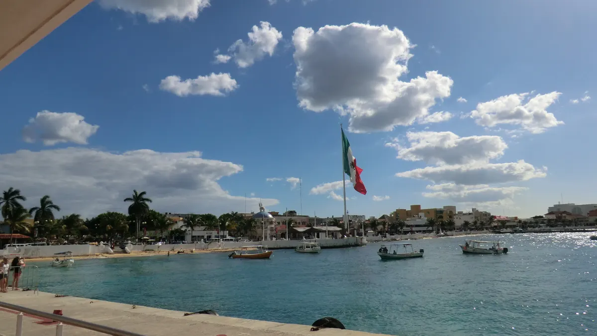
Where to stay near Playa Centro?
Search for places to stay within 5 km of the beach and compare prices for your dates on Booking.com.
Cozumel, Quintana Roo
Playa Centro is it worth it today?
Loading beach conditions…

Search for places to stay within 5 km of the beach and compare prices for your dates on Booking.com.
Good beach day. Today, Wednesday, October 28, at Playa Centro, the water is pleasant and no rain is expected, although the wind is moderate.
29°
Drizzle · low 24°
Good beach day
The beach day (9 a.m. to 6 p.m.) is over: the assessment is for the current hour.
Model estimate, not a measurement · estimated range today: 0.20 m
We check the bulletins of SEMAR's Tsunami Warning Center and of the NOAA centers for this coast. If there is a warning, follow Civil Protection instructions.
Source: CAT-SEMAR; NOAA NTWC/PTWC
Current weather warnings from Mexico's National Weather Service whose area reaches this beach.
Source: SMN/CONAGUA, CAP warnings (CC BY 4.0)
Active cyclones near the beach and, for each one, whether the beach is under a watch or warning, inside the forecast cone, or expecting tropical-storm-force winds today.
Source: NOAA National Hurricane Center (NHC)
Lightning detected by the GOES satellite in the last few minutes, up to 60 km from the beach. The satellite sees the flash in the cloud and cannot tell whether it reaches the ground. With a storm nearby, get out of the water and take shelter.
Source: GLM (GOES) published by SMN
Satellite detection near the beach, with the image date. Clouds can hide sargassum: not detected does not mean there is none.
Source: LANOT/UNAM, Sentinel-2 imagery
Result of COFEPRIS's latest enterococci testing at this beach's sampling points. It is a dated campaign, not today's condition.
Source: COFEPRIS beach monitoring
High tide around 10:00 and 22:00; low tide around 04:00 and 17:00; estimated range today: 0.20 m; rising now.
Approximate high and low tide times, estimated by an ocean model for this point on the coast. Not a tide-gauge measurement.
Source: SMOC model via Open-Meteo
Calculated for the beach's coordinates, in local time.
Source: astronomical calculation (SunCalc)
AIRE Y SALUD index estimated from model concentrations; not a station measurement.
Source: CAMS model via Open-Meteo; NOM-172-SEMARNAT-2023 bands
Chlorophyll estimated by satellite, an indicator of phytoplankton. It does not indicate algae on the beach today.
Source: Copernicus Marine
Between 24° and 30°; rain most likely tomorrow around 16:00 (96%); strongest wind around 21:00 (14 km/h).
Today · 21–02 hNow
Tonight
24–25°Clear
1%max rain
14 km/hmax wind
0.2–0.3 mwaves
Thu 29 · 03–08 h
Overnight
24°Clear
4%max rain
13 km/hmax wind
0.2–0.3 mwaves
Thu 29 · 09–14 h
Morning
26–30°Drizzle
66%max rain
11 km/hmax wind
0.2–0.3 mwaves
Thu 29 · 15–20 h
Afternoon
26–28°Drizzle
96%max rain
7 km/hmax wind
0.2 mwaves
The arrow shows where the wind is blowing to.
Today's assessment (Wednesday, October 28) is “Good beach day”: no official warning in effect advises against it. Today at Playa Centro, the water is pleasant and no rain is expected, although the wind is moderate. Waves estimated by the model, offshore: 0.3 m, period 5 s. Playas Hoy cannot see flags, currents or lifeguards: at the beach, follow the flag and the lifeguard's instructions.
No recent data. A satellite image without sargassum does not mean there is none: clouds hide it. This is a satellite detection by LANOT/UNAM (Sentinel-2 imagery), not a report from the beach.
As of today, Wednesday, October 28, no SMN, tropical cyclone (NHC) or tsunami warnings are in effect for this beach.
In the latest COFEPRIS monitoring (Verano 2026, sampled from 06/16/2026 to 06/25/2026), every point at this beach was APTA (suitable). This is the result of a sampling campaign, not today's condition.
Verdict based on the sources on this page. It does not replace the instructions of the authorities at the beach.
Sources: Open-Meteo (model), Copernicus Marine (satellite), Mexican Navy Tsunami Warning Center (CAT-SEMAR), NOAA NTWC/PTWC and NHC. Warnings: Mexico's National Weather Service (SMN/CONAGUA), licensed under CC BY 4.0. Lightning: GLM (GOES) detections published by SMN. Air quality: NOM-172-SEMARNAT-2023 bands applied to CAMS model concentrations (Open-Meteo); not a monitoring station measurement. Tide: SMOC model estimate via Open-Meteo; not a tide gauge measurement. Times are approximate; do not use the curve for navigation. Next 24 hours: model forecast (Open-Meteo). Waves: model, offshore. Water quality: COFEPRIS pre-holiday beach monitoring. Sargassum: LANOT/UNAM (Sentinel-2 imagery), lanot.unam.mx.
Weather data by Open-Meteo.com. Contains modified Copernicus Atmosphere Monitoring Service Information 2026. Neither the European Commission nor ECMWF is responsible for any use that may be made of the information it contains. Generated using E.U. Copernicus Marine Service Information; https://doi.org/10.48670/moi-00278. Contains modified Copernicus Sentinel data 2026. Licences and credits for each source
Rain, chance %